

Hermit’s Peak Trail – Santa Fe National Forest – New Mexico

Last weekend I made it back to Hermits Peak with plans to summit. I made sure I had my map (and a backup) just in case I left one in the car. The weather was perfect and nothing was going to keep me from the summit this time around.
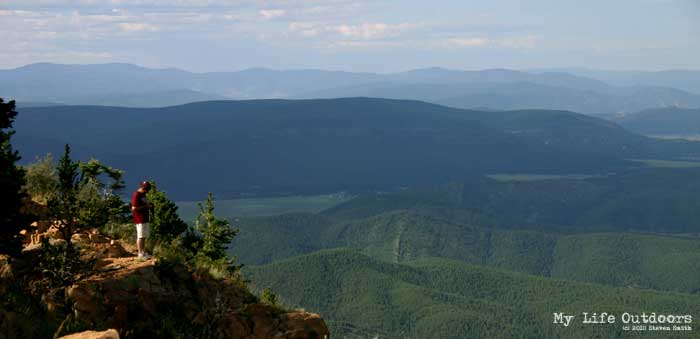
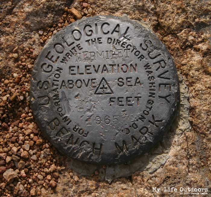
Hermits peak (10,263 feet). is at the extreme southern end of the Rockies in the Sangre de Cristo mountains. The peak rises 3700 ft above the town of Las Vegas in northern New Mexico. Hermits Peak Trail (number 223) originates at the El Porvenir Campground (7,543 feet) in the Santa Fe National Forest. The Trail is easy to follow (despite my ability to lose the trail on my last attempt.) There are a few places where the trail joins an old jeep road for a short distance and then turns back north. Watch for the trail signs and you shouldn’t have any problems.


At the beginning of the trail you will notice a sign informing you the trail passes through private property. You will pass through an open gate in a barbwire fence shortly before crossing a small stream. For most of the way the trail climbs gradually just west of the stream. At about 1.75 miles (8,600 feet) you will cross to the East side of the stream and begin the first of about 25 switchbacks. Over the next 2 miles you will steadily gain 1,200 feet of elevation.

Just after entering the switchbacks you will start to notice the canyon walls rising on each side of you.


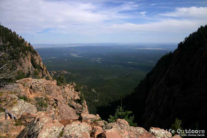
At the top of the switchbacks you receive your first really good view of the valley floor. The Santa Fe National Forest seems to go on forever into the surrounding foothills. From here its only about 0.6 miles and about 360 feet to the summit.


Sorry, the comment form is closed at this time.
YakDriver
You're making my trip to Taos take longer after each post I read. This is a must do trip for us. We really appreciate the info you put into your reviews.
lynda leonard
A small group of us will be making the ascent next Sunday. Haven't been there in years! Looking for ward to it. Heard the campground was closed and will have to call on Monday to see if it has opened up.
Best, Lynda
Paul Lyons
Paul Lyons
Richard Downs
I just wanted to take a moment to thank you for this page! I was a session 3 Blue Haven Camper (Lake Dallas FTW! :D) from 2000 to 2008. My last year, I was lucky enough to have Luke as a councilor and he agreed to take us up. There are simply no words for what it is like up there, and I have kept that experience very close. In fact, I will be taking my girlfriend of 4 years up this trail next month and proposing to her at the top. I hope she enjoys it has much as I did. 🙂 Anyway, thank you for this page and showing me the trail again. Wouldn't want to lose my way guiding her.
Montecresto
Awesome posting Steven!! I'm a backpacker (living in eastern Oklahoma) and my wife and I are closing on a piece of property in the Santa Fe Mountain Ranch in the Gallinas valley below hermits peak where we will be building a house with one all glass wall facing the peak. It's so beautiful there. Both of us will be doing that hike and camping on the summit. Thanks so much for sharing this. While I'm hear, maybe yourself, or someone else posting here could help me with some history. In about 1903, the New Mexican territorial government commissioned the construction of a "highway" though it would truly be a wagon road to link Santa Fe and Las Vegas. It was designated as hwy 22 and was constructed by prison labor. Construction was to continue from both terminuses and meet somewhere on top. Apparently they never did meet, and when New Mexico became a state, and the state government replaced the territorial government, the project was abandoned and later a road was built around the mountains the old road before I-25 was built. As I understand there are ruins of cabins from the camp the prisoners stayed in somewhere along it, and in the 1920's, Elk's lodge was built on or near it. I don't know whether it's still there (the lodge) in use or in ruins. It seems to me it would make a great backpacking trail. Does anybody know exactly where this road might be??? Thanks
Montecresto
Apparently this site doesn't get much traffic??????